
by Earle Lockerby and Douglas Sobey
Non-Fiction, 300 Pages with b/w photos and an 8-page color section of archival maps, soft cover
PEI Publication of the Year 2015
Shortlisted for PEI Book Award 2016, non-fiction
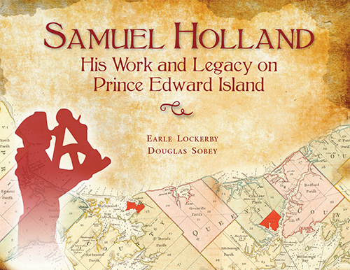 In 1764-65, surveyor Holland, on orders from the British Crown, created the first truly accurate map of Prince Edward Island, dividing it into townships and counties, and designating its county capitals, including the provincial capital Charlottetown. Holland’s map has had an enormous impact on the evolution of Prince Edward Island, shaping its settlement, its patterns of land ownership, the familiar place names that dot its landscape, even its status as a province.
This important new book will educate Islanders and visitors alike about Samuel Holland and his historic survey, and paint a detailed picture, based on Holland’s survey report, of what Prince Edward Island looked like 250 years ago – who lived here, where, and how.
ISBN: 978-0-919013-86-5
Price: $37.95 softcover. CLICK HERE TO PURCHASE
Hard cover sold out.

Accepting the 2015 Publication of the Year award from Lt. Gov. Frank Lewis, right, are Georges Arsenault, and Katherine Dewar, friends of the book’s authors, Earle Lockerby and Doug Sobey.